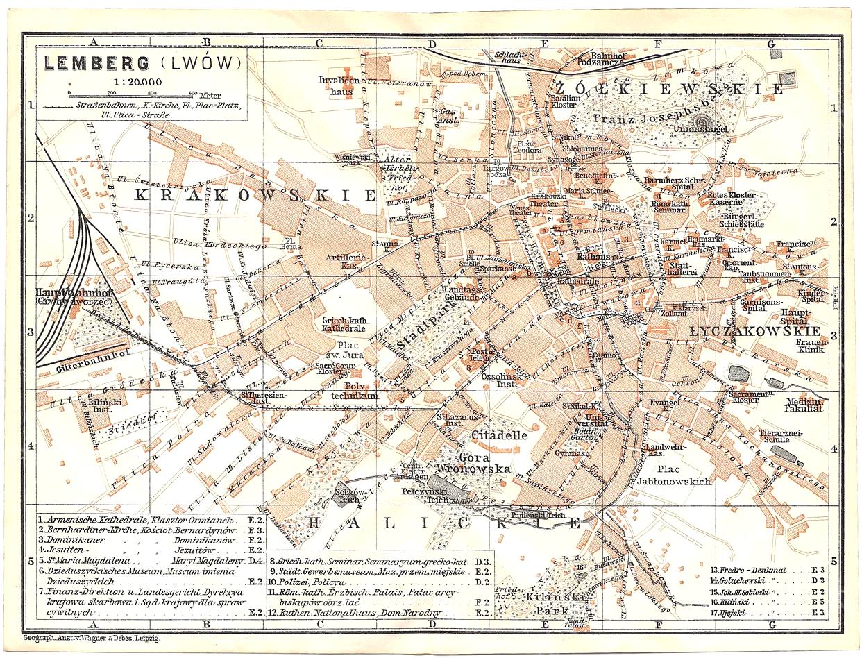
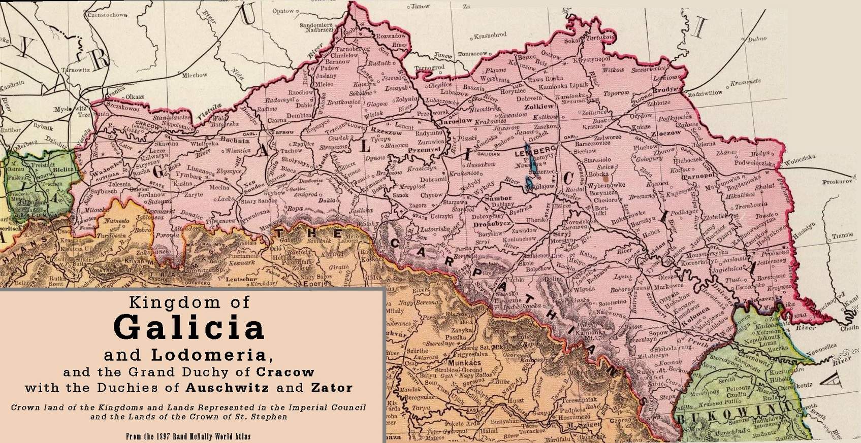
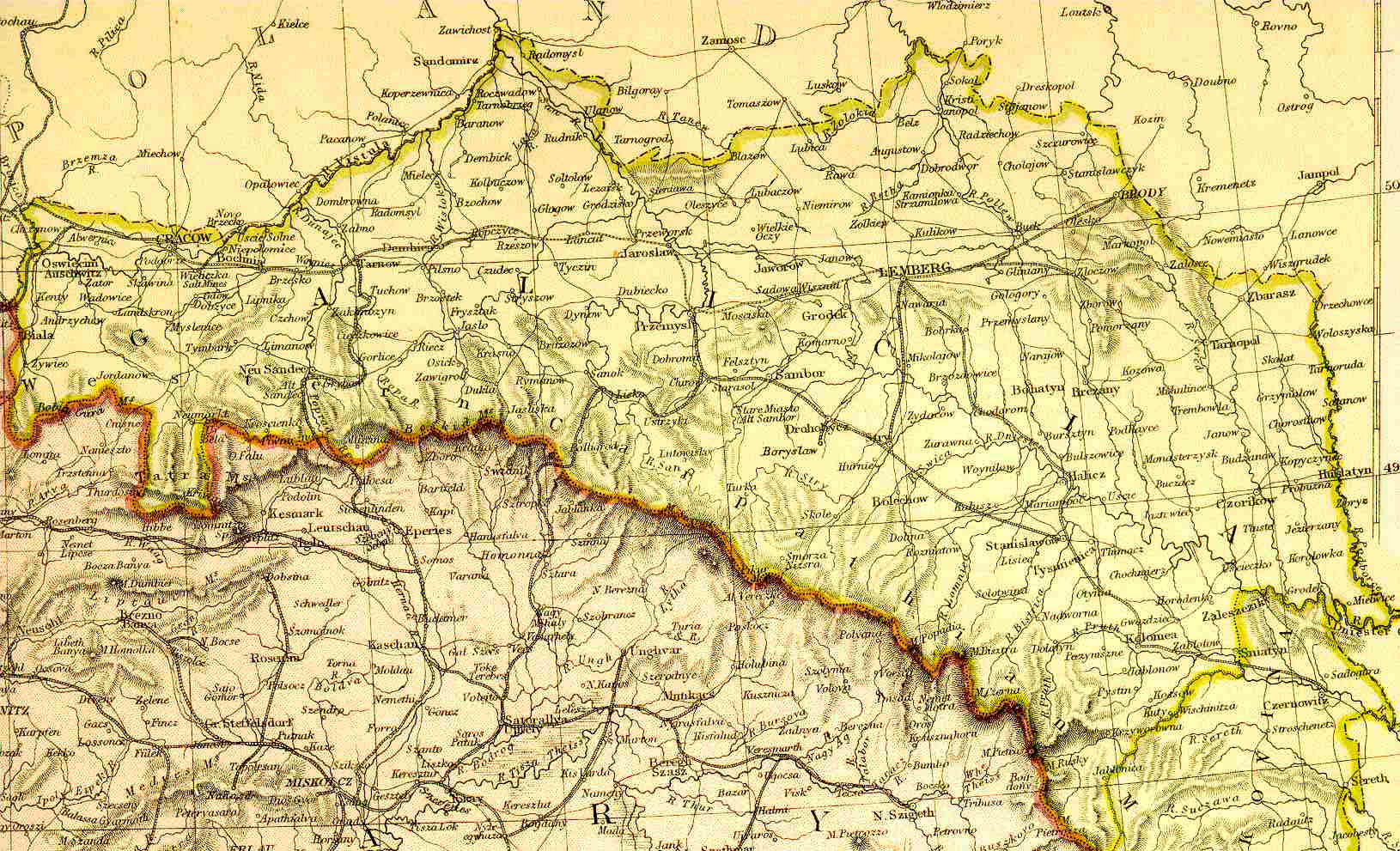
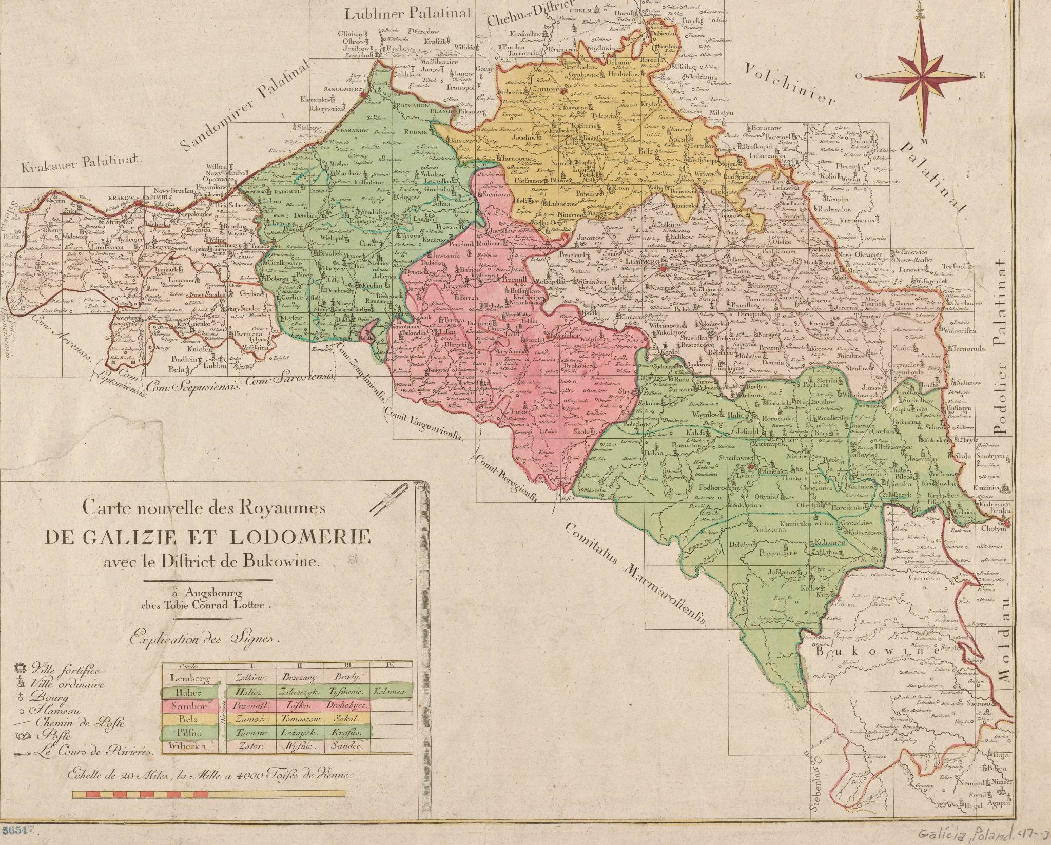
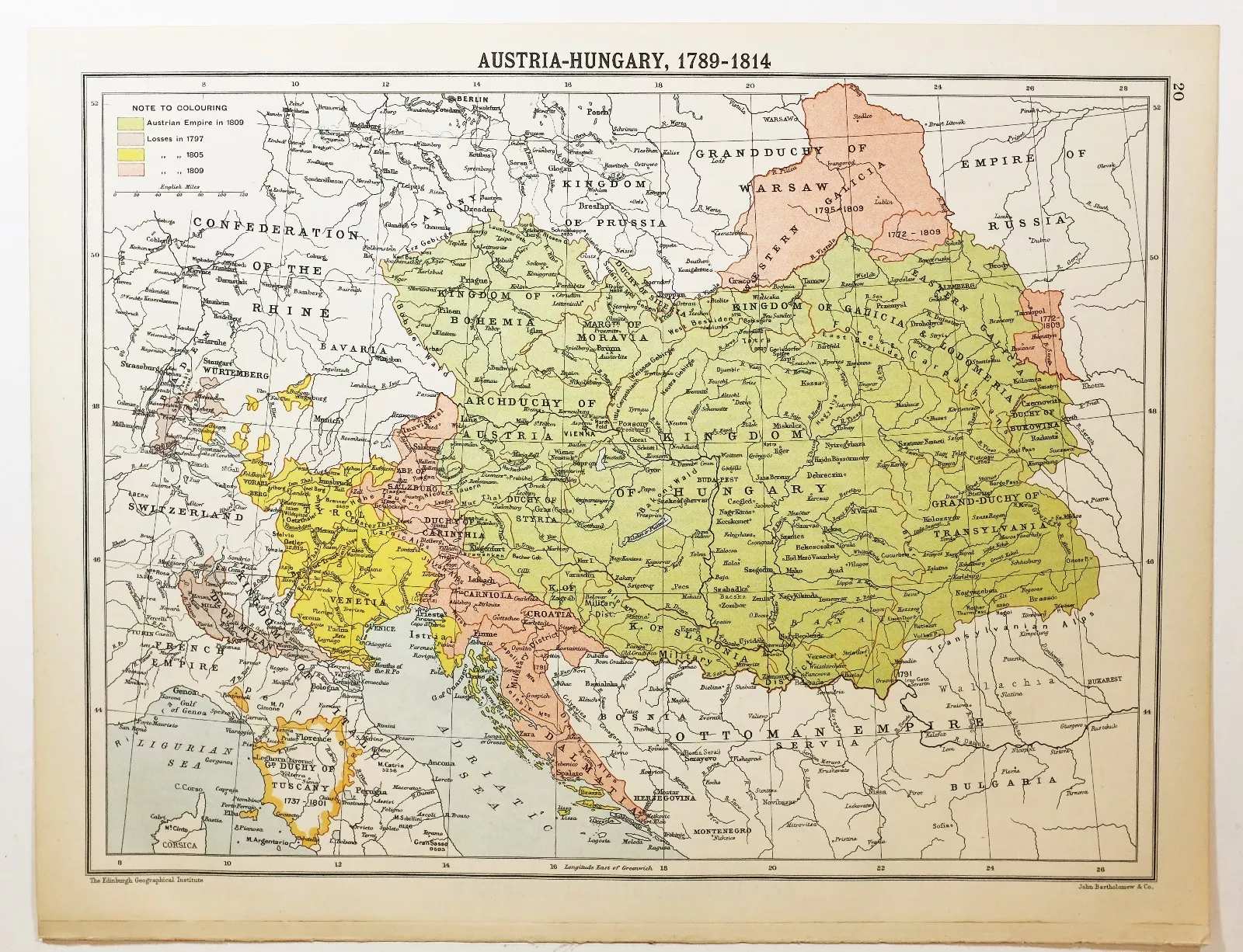
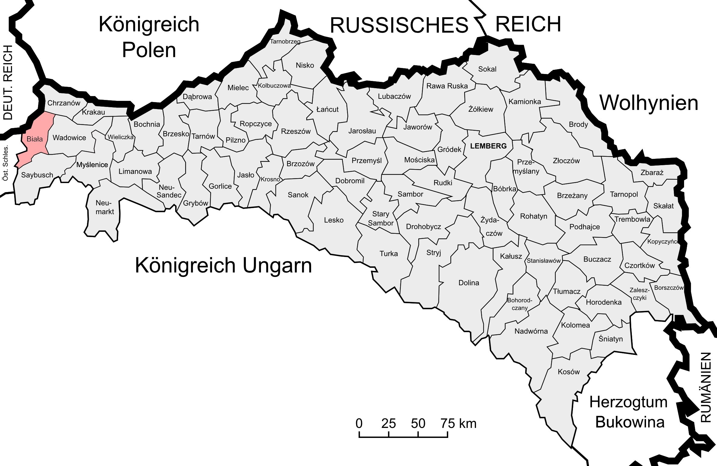
Maps of Lviv (Lemberg), Galicia, and the Austro-Hungarian Empire

Lviv Photos | Lwow-Lemberg Postcards | Galicia-Lemberg Maps | Soviet Lvov Photos

Click on any map to enlarge it. When the map opens in a new tab, you can usually click the image one more time to zoom in even further and see more details.

Historic city map of Lemberg (Lwów/Lviv), early 20th century
Detailed map of Lemberg (Lwów, now Lviv) from the early 20th century, showing the city’s main neighborhoods, railway stations, public buildings, and street layout at a scale of 1:20,000. This German-language map highlights key districts like Krakowskie, Łyczakowskie, and the Citadel area, and includes a legend listing notable landmarks such as cathedrals, monasteries, museums, and courts. Produced by Wagner & Debes of Leipzig, it is a valuable snapshot of Lviv’s urban geography before World War I.
Map of Galicia and Lodomeria, 1897
Map of the Kingdom of Galicia and Lodomeria (1897) from the Rand McNally World Atlas, showing the historical boundaries of Galicia as a crown land of Austria-Hungary. The map highlights key cities including Lemberg (now Lviv), and also covers the Grand Duchy of Cracow, and the Duchies of Auschwitz and Zator. This region was a multicultural center of Eastern Europe until 1918.
Historic map of Galicia and Lodomeria
Historic Map of Galicia and Lodomeria, showing detailed borders and major cities such as Lemberg (Lviv), Przemyśl, and Stanisławów. This map reflects the region during the Austria-Hungary period and was most likely printed between 1880 and 1914, during the final decades of its existence.
Carte nouvelle des Royaumes de Galizie et Lodomerie avec le District de Bukowine
Carte nouvelle des Royaumes de Galizie et Lodomerie avec le District de Bukowine – This detailed French map, published in Augsburg by Tobias Conrad Lotter, shows Galicia, Lodomeria, and Bukovina with administrative divisions and major towns. Created in the late 18th century, it reflects the region's new borders after the first partition of Poland (1772), when Galicia became part of the Habsburg Monarchy.
Austria-Hungary map 1789-1814, showing territorial changes
Austria-Hungary, 1789–1814 – A historical map depicting the Austrian Empire at the end of the 18th and early 19th centuries, including the Kingdom of Galicia and Lodomeria. The map highlights Austria’s boundaries, territories gained and lost during the Napoleonic Wars, and neighboring states, reflecting the shifting borders and complex history of Central Europe in this period.
Administrative map of Galicia including Lemberg (Lviv), Austria-Hungary
Administrative Map of Galicia (Austrian Partition) – This historic map shows the administrative divisions of the Kingdom of Galicia and Lodomeria during the Austro-Hungarian Empire. Major cities like Lemberg (Lviv), Przemyśl, Stanisławów and others are marked, highlighting Galicia’s role as a diverse region with Polish, Ukrainian, Jewish, and German communities.

How “Lemberg / Lviv District” was referred to in different languages: This table shows the names used for the Lviv administrative district in official documents and daily speech during the Austro-Hungarian era. Note that the Ukrainian/Ruthenian name changed as the language evolved.

Language District Name Example Pronunciation / Notes
German
(official Austrian)
Bezirk Lemberg Beh-tsirk Lem-berg
Polish Powiat Lwowski Pov-yat Lvov-ski
Ukrainian / Ruthenian Львовскій повіт (Lvovskiy povit, pre-1900s)
Львівський повіт (Lvivskyi povit, 20th c. and modern)
Early records: Lvovskiy povit
Modern: Lvivskyi povit
Yiddish לעמבערגער פאוויאט
(Lemberger powyat)
Borrowed from Polish, used in Jewish records

How “Stanislau / Ivano-Frankivsk District” was referred to in different languages: This table summarizes the terms used for the Stanislau (now Ivano-Frankivsk) administrative district, with historical and modern spellings for Ukrainian/Ruthenian.

Language District Name Example Pronunciation / Notes
German
(official Austrian)
Bezirk Stanislau Beh-tsirk Stan-is-lau
Polish Powiat Stanisławowski Pov-yat Stanislav-ovski
Ukrainian / Ruthenian Станиславівскій повіт (Stanyslavivskiy povit, pre-1900s)
Станиславівський повіт (Stanyslavivskyi povit, 20th c. and modern)
Early records: Stanyslavivskiy povit
Modern: Stanyslavivskyi povit
Yiddish סטאַניסלאווער פאוויאט
(Stanislawer powyat)
Borrowed from Polish, used in Jewish records
Lviv Photos | Lwow-Lemberg Postcards | Galicia-Lemberg Maps | Soviet Lvov Photos
📧 lvovguestbook@gmail.com Privacy Policy Copyright © 1996-2025 www.Lvov.us